
Map #35: April 17, 2017
Difficulty Level: 5
Click here for a full-size version of this week’s map.
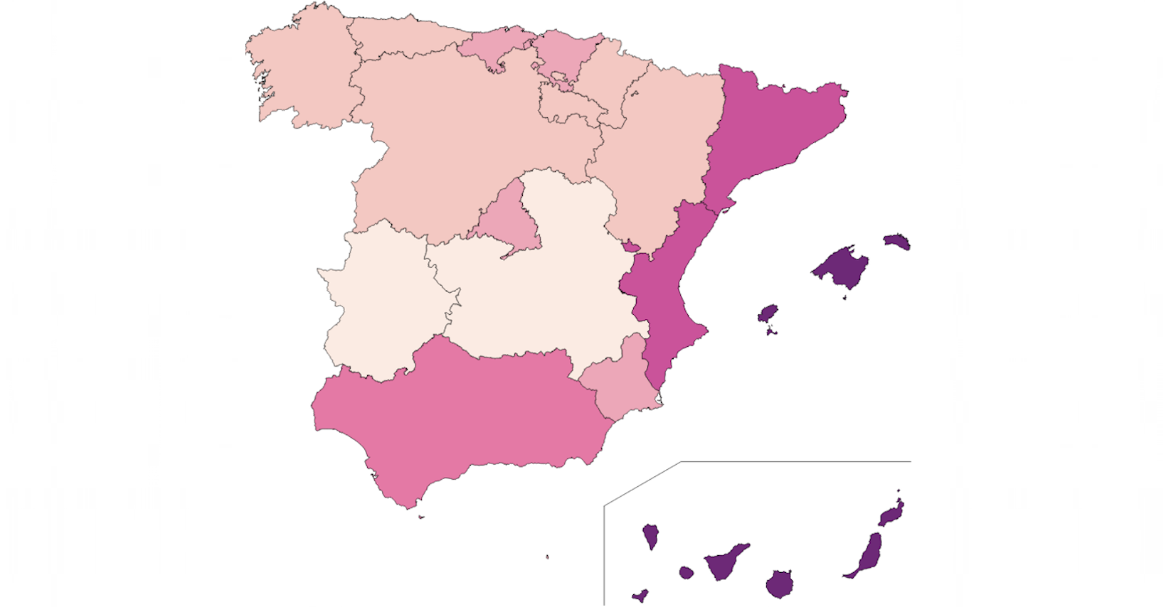
This map is a choropleth of the autonomous communities of Spain. (Do you need a refresher on what a choropleth is? Visit our “Basics” page for a quick primer.) On this map, the darker colors of pink/purple indicate regions with more of a particular statistic. For this week, you don’t have to guess the statistic precisely; we’ll be fairly lenient as long as you’re close. The statistic in question is per capita—that is, divided by the number of people in each autonomous community. We should also let you know that the scale is exaggerated (in the same manner as Map #24), so darker colors indicate regions that have much, much more of the statistic in question than the lightest areas. Your job, as always, is to figure out what this choropleth represents.
Stumped? Check back Tuesday, Wednesday, Thursday, and Friday for hints about where to focus your investigation. The answer will be posted on Monday, April 24. Good luck!
Tuesday’s hint: If you zoom way in, you can see that the enclaves of Ceuta and Melilla are on this map. These two cities are on the African continent and border Morocco, but they are part of Spain. Ceuta is a medium shade of purple—the same color as Andalucia. Melilla is one shade lighter—the same color as Madrid. These simple observations can rule out a lot of plausible answers. About half the population of Ceuta is comprised of Arabic-speaking Moroccans. Ceuta and Melilla have by far the highest percentages of Arabs, Arabic-speakers, and Muslims of any place in Spain. But on this choropleth, they don’t have extreme values. That means you can probably rule out any solution to this map that has to do with ethnicity, language, or religion.
Wednesday’s hint: In general, the areas on this map that are closer to the coast are darker than the areas in the interior. Consequently, one question you might want to consider is: what do people like to do near the coast?
Thursday’s hint: The two darkest areas of this map are island groups: the Balearic Islands in the Mediterranean Sea and the Canary Islands in the Atlantic Ocean. What can you learn about the economies of these two island groups? What do people there do for a living?
Friday’s hint: Both the Balearic Islands and the Canary Islands have beautiful beaches. To help you appreciate the natural beauty of these islands, here are some links to photos of beaches on Majorca and Grand Canary. The Canary Islands, which are the southernmost point in the European Union, have warm temperatures throughout the year. This fact has a lot to do with how dark those islands appear on this map of Spain.
Answer: Click here to see an explanation of the answer to this week’s map question.
Next map: Click here to try out our newest map question.
