
Map #56: September 11, 2017
Difficulty Level: 5
Click here for a full-size version of this week’s map.
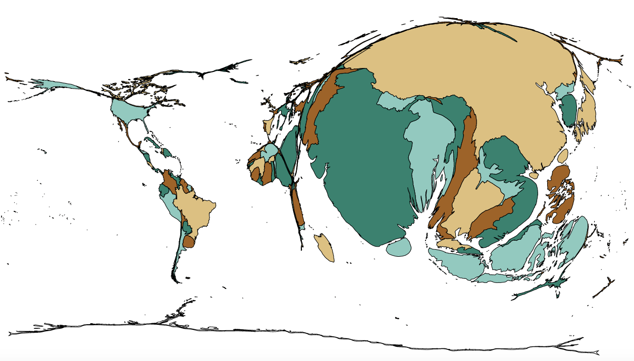
This map is a cartogram of the countries of the world. (Do you need a refresher on what a cartogram is? Visit our “Basics” page for a quick primer.) On this cartogram, each country is sized in proportion to its value for a particular statistic. The colors are only there to help you distinguish one country from another. As always, your job is to figure out what this cartogram represents.
Stumped? Check back Tuesday, Wednesday, Thursday, and Friday for hints about where to focus your investigation. The answer will be posted on Monday, September 18. Good luck!
Tuesday’s hint: Let’s start by taking a look at one of the smallest continents on this cartogram: Europe. Most European countries aren’t represented at all. But Portugal, Spain, France, Italy, and Greece are visible. All of these countries border the Mediterranean Sea. By contrast, more northerly countries such as Germany, the United Kingdom, and Scandinavia have zero area on this cartogram. The biggest European country is Italy. What are some things you might encounter in southern Europe but not in northern Europe?
Wednesday’s hint: The two biggest African countries on this cartogram are Egypt and Nigera, two countries known for being situated at the mouths of major rivers (the Nile and the Niger, respectively). What kind of land might you find at the end of a river? And what might you do with that land?
Thursday’s hint: The largest country on this map is China. But if China were broken down into its constituent provinces, it would look very different. The largest Chinese provinces on this cartogram would be Hunan, Jiangsu, Hubei, Jiangxi, Sichuan, and Guangdong, in that order. In other words, the largest provinces would be in the interior of the southeastern part of the country, in areas where the climate is hot and wet. More inhospitable regions such as Tibet and Xinjiang, both of which are quite dry, would scarcely be visible at all.
Friday’s hint: Yesterday’s hint mentioned that this cartogram has something to do with warm, wet climates. Specifically, what agricultural product would grow in such places?
Answer: Click here to see an explanation of the answer to this week’s map question.
Next map: Click here to try out our newest map question.
