
Map #108: December 17, 2018
Difficulty Level: 8
Click here for a full-size version of this week’s map.
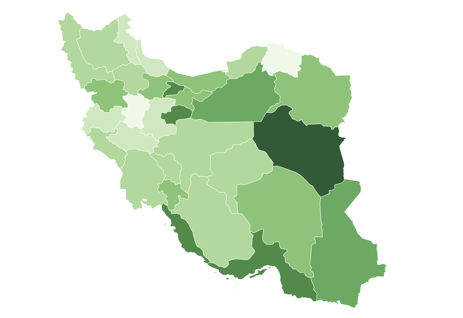
This map is a choropleth of the provinces of Iran. (Do you need a refresher on what a choropleth is? Visit our “Basics” page for a quick primer.) This will likely prove to be a difficult map for two reasons. First, most people aren’t nearly as familiar with Iran as they should be. Second, it is going to be hard to discern any coherent and consistent pattern, though there are some important conclusions that you can draw from this map. As always, your job is to figure out what this choropleth represents.
Stumped? Check back Tuesday, Wednesday, Thursday, and Friday for hints about where to focus your investigation. Since we’ll be on hiatus for the holiday, the answer will be posted when we return. Good luck!
Tuesday’s hint: To begin with, it’s worth noticing that some of the darkest areas on this map are the major oil-producing regions that line the shores of the Persian Gulf.
Wednesday’s hint: I believe (but am not 100% certain) that the reason South Khorasan is so dark on this map is because it borders Afghanistan.
Thursday’s hint: To expand on yesterday’s hint: I believe that one of the reasons why eastern and southeastern Iran is fairly dark on this map is because Iran has received a fairly large number of refugees from Afghanistan over the years.
Friday’s hint: It’s worth taking a moment to compare this map with Map #8, another map in which some of the darkest areas were the areas with the most oil production. A very similar thing is happening in this map as was happening in that one!
Answer: Click here to see an explanation of the answer to this week’s map question.
Next map: Click here to try out our newest map question.
